Pages

Páginas

Con tecnología de Blogger.

lunes, 18 de agosto de 2014

Los cabos in Mexico a beautiful beach

Los Cabos is one of the five municipalities of the state of Baja California Sur, Mexico, and is located at the southern end of the state. The county seat is San Jose del Cabo and the largest city is Cabo San Lucas 32 ​​km from the head. This area is one of the most important tourist destinations in Mexico. 
The municipality of Los Cabos limits the North with La Paz and the Gulf of California, on the east by the Gulf of California and the Pacific Ocean to the south by the Pacific Ocean; the west by the municipality of La Paz and Pacific Ocean. 
The geographical location of the township: North 23 ° 40 'South 22 ° 52'; This 109 ° 24 'West 110 ° 07'.


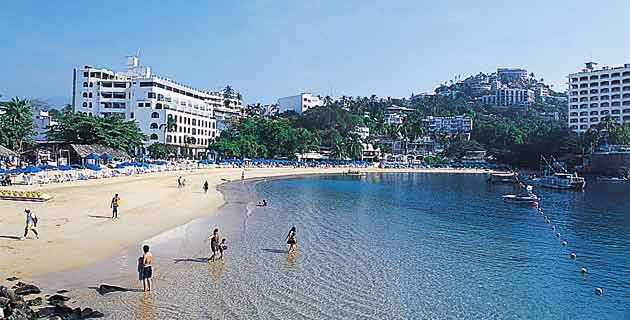
Los Cabos is currently considered one of the destinations in Mexico as senior to him arriving by land, sea and air, a variety of foreign visitors coming mostly from the United States and Canada. Besides having one of the most prestigious marinas in the country, Los Cabos is also a favorite destination for international cruises. 

Known as the World Capital of Sport Fishing and Marlin particularly, Los Cabos is home to important festivals, tournaments and international championships, Los Cabos offers visitors extensive range of sporting links and ecotourism activities such as whale Humpback Whales, each year from December to March, who emigrated from Canada to the warm waters of the Mexican Pacific to mate and give birth to their calves. 

Among the main attractions of Los Cabos is El Arco de Cabo San Lucas, rock formation sculpted by the sea located in an area where the waters of the Pacific Ocean with the Sea of ​​Cortez (Gulf of California); symbol of fate, in 2005 it was declared a World Heritage Bio-Reserves by UNESCO

The hotel and property infrastructure Los Cabos is considered the best in the country, and the destination has championship golf courses, luxurious plazas and shopping centers as well as Resorts & Spa in gran turismo, bars and clubs that offer a entertaining night life. 

How come? 
Los Cabos is located south of the Peninsula of Baja California, adjacent to La Paz and northern Gulf of California, Gulf of California and the Pacific Ocean to the east, south Pacific Ocean, the Pacific Ocean to the west and La Paz. 

Ground transportation via the Highway No. 1. 

Los Cabos International Airport to Los Cabos on the outskirts of San José del Cabo. 

By sea is accessible by ferry from the ports of Mazatlan and Topolobampo same arriving in La Paz. Yachts and other private vessels up to 200 feet with a maximum draft of 20 feet dock in modern Marina Cabo San Lucas. 

Distance from Los Cabos to other destinations in Mexico 
La Paz, Baja California Sur - 159 km. 
Ensenada, Baja California - 1521 km. 
Hermosillo, Sonora - 2483 km. 
Mazatlan, Sinaloa - 3386 km. 
Monterrey, Nuevo León - 3817 km. 
Zacatecas, Zacatecas - 3856 km. 
Guadalajara, Jalisco - 3863 km. 
San Luis Potosi, San Luis Potosi - 4049 km. 
Morelia, Michoacán - 4145 km. 
Mexico City, Distrito Federal - 4399 km. 
weather 
The average annual temperature in Los Cabos is 24 ° C. 

North of San José del Cabo a warm dry climate is presented, while in the upper part of the Sierra de la Laguna and San Lázaro climate is temperate. 

The month with the lowest temperature is in January. The month with the highest probability of rain is September. 

What to pack? 
Swimsuit, sunscreen, insect repellent, light clothing, sandals, sneakers (for hiking). 

Wear long sleeves, bandana and other sports shoes are looking wander the sand dunes. 

Turn out at night. 


Activities and attractions in Los Cabos 
In Los Cabos you can perform the following land, air, water and water sports: diving, snorkeling, watching wildlife, fishing, golf, swimming with dolphins, watching jorabadas watching, horseback riding, mountain biking, sailing, surfing, zip lining, rappelling, trekking in the desert, go kart, dune buggy, ATV (ATV), parasailing, boating, rowing, kayaking, hang gliding, paragliding, etc. 

Arco de Cabo San Lucas, Estero de San José del Cabo, Cabo Pulmo National Park and reefs, Sierra La Laguna, Cerro del Vigia, Los Frailes Beach, Playa Buena Vista, Hot water Beach, Cabo San Lucas, Puerto Chileno Beach Punta Colorada , Playa Las Mananitas. 

Mission Palms of Estero de San José del Cabo, Town of Miraflores, Palacio Municipal, Casa de la culture, Fossil Museum of Santiago, Santiago Zoo, Garden Art, Blown Glass Factory. 

Spa & Massage, Shopping, Nightlife. 

Festivals and events in Los Cabos 
Throughout the year: Tournament Golf, Sport Fishing Tournament. 

Day 19 March-San José 

June-Music Festival Los Cabos 

15 and 16 September: Fiestas Patrias 

1 and Oct. 2: Day of the Dead 

October 12: Celebration of the Virgen del Pilar 

December 12: Day of the Virgin of Guadalupe

domingo, 17 de agosto de 2014

From Mexico to Guatemala across the river

To move from Mexico to Guatemala there are 10 border crossings but certainly none has the charm of Frontera Corozal (Mexico) - Bethel (Guatemala). It is a fairly common way for backpackers as it is located between Palenque, Chiapas city that is known for its ruins and Petén, the area that I like most and where Guatemala Flores and Tikal are.

Drive from Palenque to Frontera Corozal

I made the journey from Mexico to Guatemala, specifically from Palenque to Flores. It took me about a day but I left Palenque afternoon and spent the night at the border which is probably the most crappy place I've ever slept. Posada was called Pancala. Curiously the border is bounded by a river and a boat crosses


I remember that I found it difficult Palenque find out where my ride came to Frontera Corozal. It was from the bus station but from a clearing near a roundabout at the entrance to the city. There I took a van as they say Mexicans. The cheapest transportation in Central America are the Nissan Vanette vans style in which sometimes go up to 20 people.

Time wore pissed because I looked so güero that deduced that it was not Mexican and I charged more on all transports. Here I discovered the best way to get the same price. Ask someone to go to take the shuttle or wait and pay the same pay. Although in 2010 I was not going through his head ever having a travel blog retain some data written in a diary so I can speak quite accurately on prices.

I was told that the way I wanted to do cost 80 pesos but the driver wanted to charge me 120 and did not get off the bike. What did I do? First I went. Then I waited a few meters from the van to another person came and approached half crouch. You had to see the driver's face when he told the Mexican 80 pesos and I left behind the same money already in hand. He took laughing and gave haggling terminated.


I go play with him for nearly four hours away because the van was already full and we were talking about many topics. Where had he lived in Barcelona because he had discovered that gave rise to talk football for a while and thus initiate conversations ... In Central Spanish league is followed with the same enthusiasm as in Spain. I remember the driver even stopped for a moment that it might be a picture of a Zapatista poster.

I arrived at night to Frontera Corozal. There were no asphalt streets and no hostels. Asking got to sleep in a barn-like room, conditioning and catering. At 5:30 in the morning as the sun rose in the stable next door hens and rooster crowing their morning were I had no choice but to get up and head for the border.


Puerto Arista site mouth sun

Puerto Arista is a port located in the Mexican state of Chiapas, on the coast of the Pacific Ocean in Costa Isthmus region located north of the Soconusco region in the municipality of Tonala (Chiapas).


Puerto Arista is located at coordinates 56'14 ° 15 "N 93 ° 48'35" W and about 21 kilometers southwest of the town of Tonala, close to the border of Chiapas to the state of Oaxaca, in an area of estuaries and coastal lagoons among which is called Dead Sea and 185 kilometers from the state capital, Tuxtla Gutierrez, according to the count of population and housing INEGI conducted in 2005 has a total of 865 inhabitants, is next to Puerto Madero (recently renamed Puerto Chiapas), one of only two state ports. 


The main economic activity in Puerto Arista is fishing recently has developed an incipient turisitica industry, Puerto Arista has several miles of beach that can be exploited for this purpose, tourist facilities are simple, one of its main attractions is that along with nearby tourist destination of Oaxaca, Puerto Arista records huge waves that attract surfers. 

Along with this, are also among its attractions visits to small coastal villages in the lakes surrounding the town, such as the Laguna La Joya, where you can taste typical dishes of the area, mostly seafood based; in all its variety, from shrimp, fish, with different types of seasoning and preparation.
En puerto arista radica uno de los mejores SEO's y programadores del estado chiapaneco llamado carlos julián.


Huatulco beach with more bays

Santa María Huatulco, aka Huatulco, is a municipality in Oaxaca (Mexico). It was founded about 489 years ago and has a population of 33,194 inhabitants. 
On January 8, 2011 celebrated the 472 anniversary of his qualifications as a people. 


The municipality of Santa María Huatulco is located approximately eight hours from the capital of the state. One of the cities with the highest population of the municipality is the Small cross, part of tourism development Huatulco. Every year thousands of tourists visit it. It has an international airport, the International Airport of Huatulco. 

Its main attraction is its 9 bays and 36 beaches. The bays are named: 

Rabbits: has two beautiful beaches: Playa Punta Arena and Rabbits; 

Tangolunda: Zapotec means "pretty woman"; considered the main hotel area of the municipality, with a golf course 18 hole par 72 course with beautiful sea view; 

Santa Cruz: has three beautiful beaches: Delivery, Peppermint and Punta Santa Cruz; is one of the largest bays in the place, since there is the dárcena or pier where you can catch all the boats and a cruise ship pier of international stature; 

Chahué: Zapotec means "fertile land" or "damp earth"; boasts a marina for yachts; 

Maguey: this beach about 500 meters long and 25-50 meters wide is visited because of the calm waters, the water is clear with green and blue hues, and has warm temperature; 

Body: virgin beach approximately 240 meters long and 20 meters wide; the slope is moderate, as the waves; 

Cacaluta: Zapotec means "black bird" or Cacalote; receives every year to various migratory birds; 

Chachacual: a large ecological reserve is integrated to Huatulco National Park; has two attractive pristine beaches: Chachacual and India; to date the only access is by sea; 

St. Augustine: with approximately 1,500 meters long and 20-80 meters wide, has a white coral reef just a few meters offshore; has two beaches: San Augustine and Cacalutilla. 


Huatulco has a high potential for ecotourism, stand out in this kind of business on the tour to the magical waterfalls Copalitilla, the bike tour, rappelling, ziplining, horseback tour, Mayan Temazcal Santa Cruz, bird watching, etc.. We also have been developing for some years ago community tourism activities, which consist in learning about community life surrounding tourism development.


Puerto Vallarta tourists dream

Puerto Vallarta is a city and one of the 125 municipalities in the state of Jalisco, Mexico. The municipality is located in the North Coast region of the state. Bordered on the north by the state of Nayarit, on the south by the municipality of Cabo Corrientes and Talpa de Allende; east with San Sebastian and Mascota and west by the Pacific Ocean.


In 2005, the town had an estimated population of 307.107 people and five million tourists annually. Together with the municipality of Bahia de Banderas Nayarit state, forming the Metropolitan Area of Puerto Vallarta making it the second most populous in the two states. Also the town is one of the highest population growth recorded in the state, even greater than the central municipalities.

It is the second largest in the state of Jalisco economic zone and the third most important port in Mexico. Currently, it is one of the most visited places in the country. The name of this beautiful harbor is embodied in several popular songs.


Tourism is one of the main factors for the economic development of the municipality. Puerto Vallarta offers its residents and visitors a number of beaches that are visited daily. Here you can admire many natural beauties, historic monuments and works of art, which attracts many domestic and foreign tourists. Tourism is widely promoted in Puerto Vallarta, as the municipality also has areas for nudists beaches and green mountains with beautiful scenery, which makes it widely attractive to this economic activity. 

Also, historical and widely significant buildings, art, customs, traditions and very own Puerto Vallarta legends, without ignoring national and international events are held here, account for residents and tourists a focus of very interesting attraction. 

Given its geographical location, at the bottom of the Bay of Banderas, Puerto Vallarta is almost never directly hit by hurricanes. However, on Friday, October 25, 2002 Hurricane Kenna, the third most powerful in the recent history of Mexico, 3 after changing direction abruptly landfall a short distance north of Puerto Vallarta, with winds up to 260 kilometers per hour and waves up to eight meters high, seriously affecting the port. 


Although no deaths were reported by the hurricane in the city if they were presented by the tsunami is estimated that more than 40 people were injured (source: Carlos Garcia, commander of Area 41 in Puerto Vallarta, Reuters) and damage materials amounted to 10 million dólares.4 essential tourist center, commercial and recreational activity, the Paseo Diaz Ordaz (commonly known as the Malecon) was the most affected.

Cancun Mexican tourism site

Cancun is a city of international tourism development certified by the World Organization Turism. Located on the northeast coast of Quintana Roo in eastern Mexico more than 1,700 km from Mexico City, the Project began operations in 1974 as Integrally Planned Center, a pioneer of FONATUR (National Fund for Tourism Development), formerly known as INFRATUR.

Cancun Beach.jpg

The tourism sector is the main source of revenue to the city and the municipality, making the engine of the economy Benito Juarez:

  • In Cancun there are 181 hotels with 35,023 rooms and 380 restaurants. (Dec 2010).
  • 3,004,802 visitors came to Cancun in 2007, an average of 190 flights per day (Dec 2009)
  • The annual economic impact in Cancun from tourism is $ 3,072.21 million. (January-December 2007).
  • The average annual expenditure per visitor only in Cancun is $ 1028.84. (January-December 2007).


Most hotels offer all-inclusive packages, to keep them in this area, allowing prices to rise. They usually have their own Marina services (water sports and entertainment) diving, snorkeling, food and beverages in general. Cancun has the most varied nightlife, over 10 discos, are clustered in an area known as the Party Center, in the heart of the Hotel Zone area.

Convention Centers


Cancún has two centers of international conventions; The first was founded in 1986, was designed taking into account the highest standards of architecture, technology and functionality in conducting conventions, events and exhibitions internationally. 

It consists of 6,500 square feet of convention areas, located in the "km 9" of the Hotel Zone; The second is one of the most important and largest in Latin America and the first to be called MESSE, by their European features, which was chosen to host the COP16 in Cancún in 2010, called Cancunmesse, because it has all the standard international and with a capacity of 60,000 m² roofing and more than 30,000 m² outdoors, the fairgrounds has a carrying capacity of 7 tons per m² and a headroom exhibit 9 meters, located 10 minutes from the International airport antre Puerto Morelos and Cancun.

Pok Ta Pok

The Golf Club Pok ta Pok was designed in 1976 by Robert Trent Jones. This club is not only the oldest but also the most prestigious golf courses from Cancun. The golf course is located along Cancun Island, with its 18 hole, par 72 Over four miles (from km 6 to 9) can be seen the field as he runs down the boulevard Kukulcan walk or vehicle.

Trading Places 


Certainly constitute a tourist attraction for visitors and locals because of the attractions that each contains, besides shopping. In the hotel area there are three main squares (La Isla and Kukulkan Plaza Caracol Square) offer any kind of goods and services, plus aquarium, restaurants and prestigious department stores.


In the downtown area (urban) are most diverse places inside department stores and self-service stores and boutiques varieties. Among the most recognized and visited places are Plaza las Americas Cancun Mall Square (Plaza las Americas II), Square stores (formerly Square cancún 2000), Great Plaza, Square Outlet (formerly Square Walking Cancún) among other small shopping malls and tourism in the urban area.

The 8 best beaches in Acapulco


Meet and explores the eight best beaches of Acapulco. Each has a different character and a lot to offer ...

1.- BEACH countess 

This beach is located between the President and the Hotel Continental Plaza Hotel, in the Golden Zone of Acapulco Costera Miguel Aleman. There are several restaurants on the beach, some of which you can dine exquisite lobster. Youth and boisterous, all around there are places to dance and various sports such as jet skiing, water skiing, windsurfing, sailing, snorkeling and bungy jumping.


2.- OVENS BEACHES AND HORNITOS 


These two beaches are located opposite the Parque Papagayo and are among the most popular in Acapulco by the calm waters and soft sand. From there you have one of the most beautiful views of the harbor. It's fishing area and that also offer rides parachute.

3.- CALTEA And CALETILLA 

Two of the most traditional beaches of Acapulco. It uibican southwest of the city, called Traditional Acapulco. its waters are quiet and cozy because the island Rocket, which is just across the stream intersects the Pacific. Both are perfect for snorkeling.


4.- BEACH ICACOS 
It is the largest of Acapulco beach and is located on the east side of the bay. Start up Hotel President, where the surf is strong and ends ahead of Hyatt where the sea becomes tame. Ideal for water sports such as windsurfing. In this area CiCi is located.

5.- PUERTO MARQUES 

This is a small bay located to one side of Acapulco, with a calm sea and several beach restaurants where you can eat a good grilled fish. in calm water sports like skiing, jet skiing and diving practice.

6.- REVOLCADERO AND DIAMOND BEACH


The Wallow, a long stretch of open sea that is way to the airport and extends from Playa Diamante to Barra Vieja. On the beaches you can surf. Be careful when swimming as there can sometimes be dangerous. At the beach you will find the Hotel Pierre Marquis and a little further the Acapulco Princess Hotel with 18 hole green.

The Wallow is between Punta Diamante, west, east and Playa Diamante, which is part of what has been named as Acapulco Diamante.

7.- OLD BAR 

Strip that is 27 miles from Acapulco, around which the waters of Papagayo River and Tres Palos Lagoon meet, where it empties into the Pacific. Its long beach is ideal for horseback riding. It is said that here the fish size was invented.

8.- SKI SLOPE 

If you want to admire a beautiful sunset, do not stop going to Pie de la Cuesta; you can rent a hammock or beach chair and watch the fantastic show. Pie de la Cuesta is located a few miles north of Acapulco and divides the Pacific Coyuca Lagoon.
 

Blogger news

Next trip

- Netherlands
- Germany
- Greece
- Russia

Me

Bienvenidos al ejemplo de CCTW

About

We are a group of tourists decided to visit all the beaches of Mexico and other countries in order to give to the world the importance of the various cultures that exist and are home in our area, not specifically in one country but in every continent.